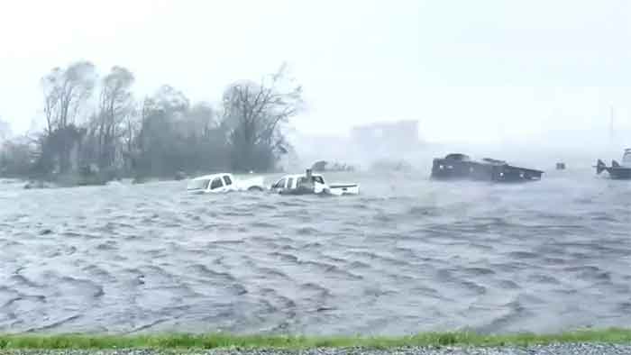
The National Hurricane Center (NHC) expects Hurricane Ida will continue to produce heavy rainfall through Monday across the central Gulf Coast, resulting in “life-threatening flash and urban flooding and significant river flooding impacts,” after it made landfall just west of Grande Isle, Louisiana, Sunday afternoon. The NHC had warned residents to expect “extremely life-threatening” storm surge inundation along the Gulf Coast within the area between Burns Point, Louisiana, to Ocean Springs, Mississippi.
Meteorologists were stunned at the rate at which Hurricane Ida strengthened. From Saturday to Sunday, Ida grew from a Category 2-level storm to a Category 4 classification. Its winds accelerated rapidly to 150 mph, nearly strong enough to be classified as a Category 5 storm, making it the most powerful hurricane to make landfall in Louisiana since Hurricane Katrina exactly 16 years ago to the date.
As of Sunday night, the entire city of New Orleans was without power, the result of what utility Entergy described as “catastrophic damage” to the transmission system, leaving in the dark those who could not or did not evacuate Sunday night. Widespread power outages were also reported in the city of Hammond, up the Mississippi River all the way to the state capital of Baton Rouge and down through the city of Houma and surrounding Terrebonne Parish.
Catastrophic wind damage is expected where the core of the storm passes, and extremely dangerous winds spread inland throughout the day. High winds tore part of the roof off Lady of the Sea General Hospital in Cut Off, Louisiana, just inland from the Gulf of Mexico. The hospital said it had suffered “significant damage” but that its patients were safe.
The failure of an emergency generator at Thibodaux General Hospital in Lafourche Parish forced the evacuation of patients from an intensive care unit to another floor of the hospital which still had power. Nurses and doctors had to handbag patients, manually providing air to patients until they could be hooked back up to mechanical ventilators.
As of Sunday night, Ida’s forward speed had slowed down, and the storm was only moving northwest at 10 mph, increasing the chances of catastrophic flooding and the amount of time its high winds will batter inland locations.
Before Ida became a named storm, forecasters believed the disturbance was just another cluster of thunderstorms. However, the storm developed rapidly because it was hovering in an area where the wind was not fast enough to carry the ocean’s heat away from the system. Ida’s rapid intensification, which exceeded forecasts, was due to extremely warm ocean waters and ideal conditions in the atmosphere as well.
Human-caused climate change, by warming air and ocean temperatures, is leading to both stronger and wetter hurricanes, and more storms that rapidly intensify. The Gulf of Mexico’s unusually warm and deep waters provide ideal conditions for the development of severe storms.
On Twitter, meteorologists across the country expressed alarm at Ida’s rapid evolution into a colossal threat.
“I desperately wish the forecast hadn’t become reality,” said Rick Knabb, a hurricane expert at the Weather Channel, adding that rapid intensification before landfall is “the hurricane scenario we’ve always dreaded.”
Eric Blake, a senior hurricane specialist at the NHC, said, “I feel sick to my stomach watching this hurricane. This is a very sobering morning.”
“I feel ill watching this hurricane,” Kim Wood, a meteorology professor at Mississippi State University, said on Twitter.
“Sunrise reveals an absolute monster. The rapid intensification to the point of landfall is what meteorologists fear most with tropical cyclones,” Steve Bowen, a meteorologist for reinsurer Aon, tweeted.
Ida’s rapid development also caught state and city officials off guard. After the NHC updated Hurricane Ida as a serious threat, New Orleans Mayor LaToya Cantrell announced Friday that there was no time to order a mandatory evacuation of the city. Cantrell said that, due to the timing of Ida’s landfall, the city was unable to put together a contraflow plan needed to quickly evacuate people.
Residents of the city inside the levee system had been told to ride out the storm, while those living outside the levees were placed under a mandatory evacuation order. Louisiana Governor John Bel Edwards said Sunday afternoon that more than 1,540 people were in evacuation shelters throughout the state, though that number is expected to rise.
The Weather Prediction Center estimated most areas could see as much as 8 to 16 inches of rain through Monday, and in extreme cases up to 2 feet. In New Orleans, the National Weather Service said 15 to 20 inches of rainfall or more could fall, overwhelming the city’s fragile pumping system and causing extensive flash flooding.
Power outage monitors reported that over 430,000 households in southern Louisiana were without power Sunday, with warnings that outages could persist for weeks. The Sewerage & Water Board of New Orleans announced that many of its sewage pumps are experiencing power outages, increasing the potential for sewage backups and flooding.
Storm surges between 12 to 16 feet have been recorded across south coastal Louisiana, between Port Fourchon and the mouth of the Mississippi River. The NHC called the surge “extremely life-threatening.” Storm surge flooding is also underway farther east into Mississippi.
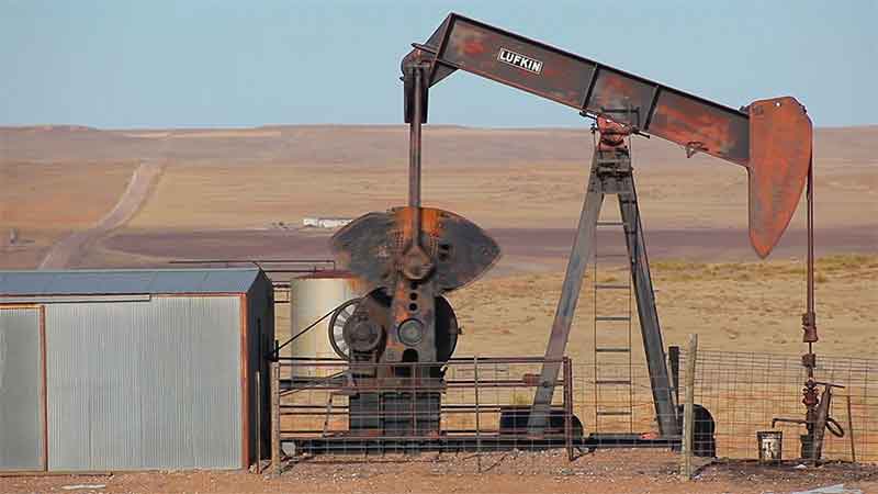
Numerous oil and gas facilities and chemical plants were in the path of some of the strongest winds and storm surge, including Port Fourchon, which is considered integral to the Gulf of Mexico’s oil and gas production. Officials worry that damage to infrastructure along the coast and upriver, between New Orleans and Baton Rouge, could lead to environmental hazards and disrupt oil and gas production in the Gulf.
As of the time of this writing, the NHC still categorized Ida as “extremely dangerous.” Ida’s top wind speeds had decreased slightly, down to 125 mph, which still made it a Category 3 storm. Ida is expected to weaken during the next day or so but is forecast to remain a hurricane late through the night and remain a tropical storm until Monday afternoon. The storm system is expected to bring heavy rains, resulting in flooding in Tennessee, Kentucky, West Virginia and on through the Mid-Atlantic as it progresses through mid-week.
Originally published in WSWS.org


