Sixth Abhee Dutt Mazumdar Memorial Lecture, Kolkata, 26 July 2019
INTRODUCTION
Honouring Abhee Dutt Mazumdar

It is a great honour to deliver the Abhee Dutt Mazumdar Memorial Lecture this year. I did not ever meet him, but had heard of him. He was a brilliant nuclear scientist who died at the early age of 45 in December 2013. After getting his PhD from the Saha Institute of Nuclear Physics, Kolkata, he spent time doing research in France, Germany and Canada, before returning to Kolkata, where he first joined Bose Research Institute, then went back to Saha Institute. He was a prolific writer and in a short span he had 61 research publications to his name.
But Abhee Dutt was not just a scientist. He was an activist who wanted social and economic justice for the poor and the downtrodden. He challenged the current “development” paradigm by pointing out how big business always monopolized education, culture, industry, agriculture, water, food, land environment and power. He believed that the green revolution created a food surplus but did not eradicate hunger, and warned against a second green revolution that would replace pesticides with genetically modified plant varieties. He warned that big corporations use their experts and clout with the media to create the illusion of employment and poverty eradication. And so he led movements against nuclear power plants, chemical hubs, GM foods and Special Economic Zones.
I dedicate this lecture on impending water conflicts to Abhee Dutt’s memory. Instead of water being treated as a “common” where it is freely available to all, it is now being increasingly privatized where it will be available only the privileged—both countries and individuals. More importantly, instead of water being treated as resource that all living beings should share equitably, humans have monopolized it to the detriment of biota other than humans and to abiota. To realize Abhee Dutt’s dreams, both these aberrations must be reversed for us to become a sustainable and equitable society.
Legend of Cauvery’s origin
As a Hindu legend goes, asura (demon) Surapadma was angry with God Indra for escaping arrest while trespassing on his land, and odered Varuna, God of water, to banish Indra from South India. To flush Indra out, Varuna used scotch earth tactics and made rains fail in South India. Famine, hunger and death stalked humans, and forest and animal died.
Soon after Agasthya muni (sage) passed through this land and was moved by the enormity of the disaster he saw. He prayed to Shiva for a boon that will provide relief to all affected people, animals and non-living things. Shiva gave Agasthya a kamandalam (vessel) of holy Ganga water and told him that a mighty river would emerge from where the holy water was poured, and added that the river’s water was meant for all biota and abiota.
Agasthya searched for the perfect spot for the headwater of this mighty new river, but did not find one quickly. Meanwhile people, animals and the vegetation continued to reel under the drought. Lord Ganesha could bear to see this suffering no more and decided to act. On a hot afternoon, while Agasthya was resting under a tree at Bhagamandala, Ganesha came in the form of a crow and toppled the kamandalam. The mighty Cauvery River instantly started flowing eastwards from Talakaveri, in Kodagu District, 8 km from Bhagamandala, connected with other streams, and together, they healed one lakh km2 of parched lands.
WATER CONFLICTS BETWEEN HUMANS
Cauvery River water dispute
In the wake of the Supreme Court’s decision, the Cauvery River water dispute between Karnataka and Tamil Nadu exploded into street riots in Bengaluru during the second week of September 2016, followed predictably by bandhs (shutdowns) in Tamil Nadu. Some rioters in Karnataka raised the slogan Nama Cauvery (our Cauvery), implying that Cauvery belonged to Karnataka because it originates in that state, and Tamil Nadu got Cauvery water because of Kanadiga generosity. What is the slogan’s genesis, and how can the longstanding water dispute over Cauvery waters be solved?

Fig 1 Cauvery River basin falling in four states
The Cauvery River water issue is more than a 100 years old. To understand it, recounting a bit of history is necessary. The Cauvery River flows through three regions—the Brahmagiri hills, where it originates in Kodagu District the Western Ghats, the Maysuru plateau and the delta region, which is present day Tamil Nadu. The delta farmers, like in all deltas, were the first to use Cauvery water to irrigate their farms. The origins of elaborate canal and tank irrigation system in the Cauvery delta dates back a thousand years, to the Chola period. In the 19th Century the plateau farmers realized that they too could tap Cauvery water, but it took them a hundred years more to start building dams and canals in the Mayasuru plateau.
To forestall possible water disputes, the British ruled Madras Province and the princely state of Mysore signed a water sharing agreement in 1892, followed by another in 1924. Both agreements protected the then existing delta farmers’ water use quantities and required the Maysuru government to seek the consent of Madras government prior to the construction of any upstream water works. Though a few dams existed in the Cauvery basin prior to 1947, dam construction picked up from the mid-1960s and peaked in the next three decades.
As the water dispute between Karnataka and Tamil Nadu intensified, the Cauvery Water Disputes Tribunal was set up in 1990 under the Inter States Water Disputes Act, 1956 to arrive at an amicable settlement. Its two awards, including to two new stakeholders—Kerala and Puducherry, are summarized below.
Table 1 Basin area and water awarded to various states[i]
| State | Karnataka | Tamil Nadu | Kerala | Puducherry | To sea | Total |
| Basin area (km2) | 34,273 | 44,016 | 2,866 | 148 | 0 | 81,303 |
| Share (%) | 42.2 | 54.1 | 3.5 | 0.2 | 0 | 100 |
| 2013 award (tmc) | 270 | 419 | 30 | 7 | 14 | 740 |
| Share (%) | 36.5 | 56.5 | 4.1 | 0.9 | 1.9 | 100 |
| 1990 award (tmc) | 177 | 566 | 5 | 0 | 0 | 748 |
| Share (%) | 23.7 | 75.7 | 0.7 | 0 | 0 | 100 |
| Source: Pildat | ||||||
In the 2013 award, Karnakata and Keralas’ water share increased and Tamil Nadu’s decreased in comparison to the 1990 award, and Puducherry for the first time obtained a small fraction of Cauvery’s water. Dissatisfied with the awards, the stakeholders repeatedly petitioned the Supreme Court for greater shares. Conflict intensifies in deficit rainfall years as a water sharing formula in such years had not been spelt out. The Supreme Court then has to then pass ad hoc water sharing orders. The issue is compounded by increased water needs of each state due to an increase in irrigated lands, shifts towards crops that need more water, and greater urbanization and industrialization.
Water disputes—an ancient, persistent global problem
The Cauvery River water dispute is not unique. Water disputes have been a persistent global problem dating back 5,000 years ago. One of the earliest recorded conflicts over water occurred between the states of Lagash and Umma in the fertile Tigris-Euphrates valley about 4,500 years ago. To secure its water supply, Lagash constructed canals to divert water from the Shatt-al-Gharraf River. This affected Umma’s water supply, and that resulted in conflict between these neighbours.
In more recent times the sharing of water between upper and lower riparian states has caused serious conflict in many parts of the world. In each of the cases discussed below the ecological boundary of the river basin and political boundaries of the states that occupy the river basin do not coincide.
Jordan River
The sharing of the Jordan River waters has caused much conflict in the latter half of the 20th Century. The Jordan River is formed by the meeting of three tributaries that originate along the slopes of Mount Hermon—the Hasbani in Lebanon, the Baniyas in Syria and the Dan in the northern corner of Israel. The Jordan River then flows south along the eastern border of Israel into Lake Tiberias. From Lake Tiberias the Jordan River runs further south after meeting another tributary from Syria, the Yarmuk River, forming the border between Israel and Jordan and subsequently the border between the West Bank and Jordan. The river finally joins the Dead Sea at the southern end of the West bank.
Even though the Jordan is only a medium-sized river with an annual average flow of 1.2 bcm, i.e., 2% of that of the Nile, it is a lifeline for those living in the arid regions around it.
The British who controlled this region before World War II, proposed plans in 1939 and again in 1944 to construct canals to carry Jordan River water the parched areas southeast and southwest of the river. But before they could be implemented, the Hashemite Kingdom of Jordan and the Israel state were established soon after World War II and they developed their own independent plans to tap the Jordan River. Israel drained the Huleh swamp north of Lake Tiberias and planned to construct a National Water Carrier (NWC) canal to divert water from Lake Tiberias to the populated coastal areas and the Negev Desert. Jordan signed an agreement with Syria in 1953 to divert water from the Yarmuk River into canals that would irrigate western Jordan.
Sensing that a serious conflict was underway, the US appointed Eric Jhonston as a special commissioner to help the contesting countries arrive at a water sharing agreement. After two years of negotiations, the countries agreed that Jordan would get most of the Yarmuk water and a small share of the Lake Tiberias water, and Israel would have control over the Upper Jordan River and could divert a significant amount of water from Lake Tiberias into the NWC canal. But just before the agreement was signed, both Israel and Jordan pulled back. Israel was fearful of allowing Jordan control over some part of Lake Tiberias, and Jordan did not want to sign an agreement it would confer Israel with de facto recognition.
After the Johnston initiative failed, the Arabs began viewing the NWC canal as a means for Israel to steal Jordan River water. In 1960, Syria and Jordan agreed to dam the Hasbani in Lebanon and the Baniyas in Syria and divert their water via the Yarmuk into the East Ghor canal, bypassing the Upper Jordan River and Lake Tiberias, the intake point for the NWC canal. Without the 260 mcm yield from the Hasbani and Baniyas rivers the NWC canal would become a dud investment, and more importantly, Israel would be water starved. In 1960, Foreign Minister Golda Meir warned that diverting the Jordan River headwaters was “an outright attack on Israel’s means of livelihood,” and in 1964 when Syria implemented water diversion, Premier Levi Eshkol warned that “Israel would act to ensure that waters continued to flow.”

Fig 2: The Jordan River
In 1964, as the NWC canal neared completion and the Hasbani and Baniyas water diversion project were underway, the contestants for the Jordan River’s water felt that the stakes for procuring what they felt was their rightful share of the water had been raised. They militarizing the conflict which till now remained at the diplomatic level. Israeli and Syria clashed on the ground and in the air. And finally in 1966, Israel bombed the water works being constructed by the Arabs.
Control over the Jordan River water may not have been the sole reason for the June 1967 Six-day war between Israel and the Arabs, but it certainly was one of the main ones. By occupying the Golan Heights on the eastern bank of Upper Jordan River and the West Bank, until then under Jordan’s control, Israel secured Jordan River water flow into the NWC canal. Things remained quiet until Jordan and Syria revived plans in the 1980s to dam the Yarmuk River. Israel objected to this project as it felt that it would reduce water for the Israeli settlements on the Golan Heights and threatened to use any means possible, including military, to stall the project.
In 1991, to further the peace process Israel signed an agreement with the Arab countries to reduce its water drawl from the Jordan River by a small fraction and allow it flow into Jordan’s irrigation canals. Yet, as an occupying force, Israel has ensured that the per capita availability of water to Jewish settlers is 6-8 times that of the Palestinians in the West bank. Such blatant inequality is a recipe for conflict in future.
Nile River
The Nile is the longest river in the world and drains an area as large as India in 10 countries—Tanzania, Burundi, Rwanda, Democratic Republic of Congo, Kenya, Uganda, South Sudan, Ethiopia, Sudan and Egypt. The Nile valley is the cradle of one of the most ancient civilizations of the world and a secondary domestication site for plants and animals dating back to 8,000 bp.
Conflict over Nile River water sharing has a long history. In 1920 Sir Murdoch McDonald, the senior British engineer in Egypt proposed the ‘Century Storage Scheme’—a series of dams in the upper Nile that would store water during good rainfall years so that it could used in years with less rainfall in the entire Nile valley. Egypt, which became independent in 1922, opposed the plan as it would give greater control of the Nile waters to upper riparian regions. In 1929, before the first Nile water agreement was signed, Egypt extracted a promise from Great Britain, which controlled a bulk of the upper Nile riparian region, that no works would be constructed on the upper Nile or its tributaries controlled by Britain without the prior approval of Egypt.
After World War II, the upper Nile region broke up into several newly independent countries. The prospect of integrated basin-wide harnessing of the Nile waters became less feasible. Sudan declared the 1929 agreement was not applicable to it and Ethiopia, which never signed the agreement, proposed big irrigation projects to tap the Blue Nile that flowed through its territory.
Alarmed with these developments, Egypt constructed the Aswan High dam which assured them 160 bcm of water and used diplomatic and economic pressures and military threats to dissuade Sudan from proceeding with their plans to construct dams in their territories. Sudan finally signed a water sharing agreement with Egypt in 1959 that replaced the 1929 agreement. Under the new agreement, Egypt and Sudan got 66 and 22% of Nile’s water, the rest being lost to evaporation and runoff.

Fig 3: The Nile River
The 1959 agreement between Egypt and Sudan brought temporary relief from water conflicts for these two countries. Excluding Ethiopia and the other upper riparian states from the agreement and giving Sudan what is perceived as less than its fair share of Nile’s waters is a sure way of ensuring conflict at a future date. Internal strife in Ethiopia and Sudan and the consequent formation of Eritrea and South Sudan has temporarily pushed water conflicts into the background. To protect its future interest Egypt continues to use all possible means—economic, political and military, including aiding rebels in Sudan and Ethiopia—to dissuade the upper riparian states from tapping additional water from the Nile. In 1995, Sudan declared that it may wish to replace the 1959 agreement with a new one. Egypt’s President Hosni Mubarak responded saying that “Any step taken in this direction will force us into confrontation to defend our rights and life. Our response will be beyond anything they can imagine.” As Egypt is the dominant power in the region, Sudan backed off from its demand.
Tigris-Euphrates Rivers
The Tigris and the Euphrates originate in the Anatolian highlands of Turkey. The Euphrates flows south to enter Syria, where it swings to the southeast and flows into Iraq. The Tigris flows southeast in Turkey to enter Iraq about 400 km north of where the Euphrates enters Iraq. In Iraq the two rivers flow to the southeast, almost parallel to each other for 900 km, in a 250 km wide valley. They meet at Al Qurna to form the Shatt Al-Arab River which flows for another 200 km before discharging into the Persian Gulf. Together the two rivers have a much greater discharge than the Jordan River and have provided water to an area that hosted the ancient civilization in Mesopotamia. Almost 90% of the flow in the Euphrates is from its catchment area in Turkey, whereas for the Tigris it is 50%. The economies of Syria and Iraq are highly dependent on these two rivers.
All three countries have dammed the rivers for flood control and diversion of water into irrigation canals. Issues other than water sharing divide these countries. Turkey and Syria have been in conflict over the province of Hatay, which originally was a part of Syria but was ceded by France to Turkey in 1939, and over Syria’s support to the Kurdish Workers Party (PKK) in Turkey. In 1975, Iraq charged Syria of decreasing water flow in the Euphrates with the newly built Tabqa dam, which Syria denied. The Arab league failed to settle the dispute resulting in a diplomatic war and a military standoff between the antagonists. Syria and Iraq stood down only after Saudi Crown Prince Fahd pleaded with them to settle their dispute through negotiations. Yet, their wrangling continued until a bigger threat loomed on the horizon in 1990.

Fig 4: The Tigris and the Euphrates Rivers
In 1987 Turkey signed an agreement with Syria to maintain a flow of 15.7 bcm/year in the Euphrates in return for Syria discontinuing its support for the PKK. Syria and Iraq now perceived Turkey’s ability to control their water as a serious and common threat and quickly agreed that Syria would allow 58% of the water it received from Turkey to flow into Iraq. Syria and Iraq saw Turkey’s action as a precursor of things to come as Turkey progressed with its plan to develop a series of dams on the Tigris and Euphrates under the Southeast Anatolian Project. Dissatisfied with Syria’s action against the PKK, Turkey cut off all water in the Euphrates for a month to fill up the Ataturk dam in February 1990. This and Turkey’s other aggressive postures finally made Syria take more decisive action to cut off support to the PKK. In 1998, Syria signed an agreement with Turkey to close PKK training camps in Syria and expel PKK’s leaders. While this move cooled the tension `between Turkey and Syria, Turkey’s dam construction plans were never shelved and will continue to be a cause for conflict between the Turkey, Syria and Iraq.
The Indus Water Treaty
The Indus Water Treaty is a distribution treaty between India and Pakistan of the water in the Indus and its tributaries flowing through India. The treaty was brokered after years of negotiations in 1960 by the World Bank. The treaty gives India 40.6 bcm of the water in the three eastern rivers—Sutlej, Beas and Ravi—amounting to 16% of the 210 bcm of total available water in the Indus and its tributaries. Pakistan gets 98.4 bcm of water flow in three western rivers—Indus, Jhelum and Chenab—that flow in India, as well as the flow of the Indus in Pakistan. India can however use a limited amount of water from the western rivers for agricultural uses, hydro power generation, domestic and non-consumptive purposes.

Fig 5: The Indus Water Treaty
After the 2016 Uri terrorist attack, India threatened to withdraw from the Indus Waters Treaty. Prime Minister Narendra Modi declared, “blood and water cannot flow together,” but no action was taken. After the 2019 Pulwama attack, Nitin Gadkari, Minister for Roads and Water Resources stated that all water presently flowing in to Pakistan in the three eastern rivers will be diverted to Punjab, Haryana and Rajasthan.
Pakistan is aware that it is critically dependent on the Indus waters for its survival as it is the only major river it has. It is worried that even if there is a decrease of 5% flow of these waters, the impact on its agricultural production, farm incomes, nutrition standards, and its economy in general, would be disproportionally large.
A pattern to water disputes
There is a common thread to the above water disputes. The salient features of them are:
- Incongruence between ecological and political boundaries is a recipe for conflict
Ecological boundaries are carved by nature. Political and administrative boundaries are made by humans based on language, culture and more importantly on the political and military strength that a state possesses. Ecological and political boundaries rarely coincide. The boundaries of the Cauvery, Nile, Jordan and Tigris-Euphrates basins are not congruous with those of the states that occupy their basins, e.g., the Cauvery basin falls in states of Karnataka, Tamil Nadu, Kerala and Puducherry.
As each state attempts to maximize its water share it comes to conflict with other states that use water from the same river, particularly during lean rainfall years when river water supply dwindles. Over the years, water conflicts have increased. In the coming decades population rise and industrialization will increase water demand in all riparian states, and even if precipitation remains constant, as long as demand for water keeps rising, conflict is likely to increase further.
- Contradictory doctrines used by upstream and downstream riparian states to claim water
Aggrieved by what it perceived as a historical injustice in the sharing of Cauvery water, Karnataka uses the 100 year old Harmon doctrine to stake its claim on all the water that flows in the Cauvery River in Karnataka state. The doctrine, named after a US advocate general, bestowed a territory with absolute rights over its water resources. Whereas Tamil Nadu finds it convenient to perceive the Cauvery water sharing issue through the lens of the doctrine “Prior appropriation of water rights,” another US legal doctrine that was born out of water scarcity in western US states, that protects the rights of the first users of a water source, and allows subsequent users to draw water from that source as long as it does not impinge on the rights of the first users. In each of the other water disputes discussed above the upper and the lower riparian states use arguments similar to ones that Karnataka and Tamil Nadu have used to buttress their positions.
The doctrines used by the upper and lower riparian states are irreconcilable. Their dispute can be solved only by a neutral body, provided both sides are willing to abide by the decision of that body. Alas this is rarely the case. Alternatively, the dispute can be resolved by direct agreements arrived at by water users on both sides of border based on the principle of equity.
- River water dispute stages
River water disputes between societies go through three distinct stages:
- Stage 1-No dispute or mild incipient dispute: When water abstraction as a fraction of its availability in a river is low, water disputes are either absent or are mild and incipient. This could either be because ecological boundaries of a river basin fall within political boundary of a single state, or the boundaries are fuzzy, or there is sufficient water for the water demands of all the riparian states coupled sometimes with a formal or an informal water sharing agreement between the riparian states.
- Stage 2-Dispute: An active dispute arises between upper and lower riparian states over water sharing. The dispute is often coupled with either action or announcement of future action by one or more riparian states that they intend to increase their water share. Attempts are made to resolve the dispute through dialogue, adjudication or arbitration, diplomacy and third-party mediation. Threats to resolve the dispute by military means may be issued.
- Stage 3-Militarization of the dispute: When all other methods to resolve the dispute fail, military solutions are resorted to.
The Jordan River water dispute reached Stage 3 , whereas the other disputes discussed above are somewhere at Stage 2.
- Water is often used as a bargaining chip to settle other disputes
In the Tigris-Euphrates dispute, Turkey threatened to block Euphrates water as a bargaining chip to get Syria to discontinue support to PKK. India is now threatening to do something similar with the Indus Water Treaty to get Pakistan to withdraw support to terrorists using Pakistan soil to strike against India.
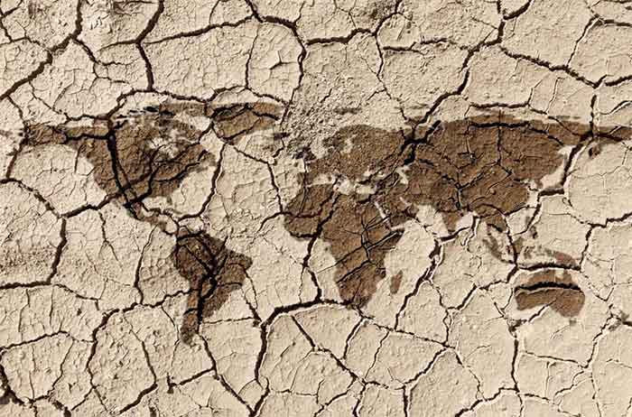
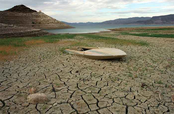
WATER AVAILABILITY WILL CHANGE IN FUTURE
That water availability in rivers—its total yearly quantum and the pattern of fresh inflows, with its normal yearly and seasonal variation—is more or less constant, can no longer be taken for granted. Water availability will change in future due to two factors—acidic gases and climate change, both being products of fossil fuel burning.
Soil acidification and water stress in the Deccan Plateau
Acidic gas (SO2, NO2) emissions from power plants travel large distances, even up to 3,000 km from their source. Acidic gases from power plants in Krishnapatnam, located on India’s east coast, have been modelled to reach the Kudremukh National Park in the Western Ghats, an aerial distance of 500 km, in just one day.
Soils in the Western and Eastern Ghats have a low pH and therefore have poor capacity to neutralize deposition of acidic gases. Low soil pH causes injury to vegetation by decreasing nutrient availability, increasing toxin solubility in soils, impairing nitrogen fixation, and increased attack by soil pathogens.
Ecosystems such as the Western and Eastern Ghats, when subject to acidic gas deposition over decades, become unprotected ecosystems. Once unprotected, vegetation in such ecosystem are impacted in several ways—plant growth becomes retarded; their vitality is reduced; their drought and pest susceptibility is increased. In turn, this leads to forest dieback and alteration of species composition in the ecosystem.
Long range ecological forecasting indicates that acidic gases from thermal power plants will further acidify Western and the Eastern soils and make them unprotected to further soil acidification with consequent forest dieback. This will diminish the capacity of the Western and Eastern Ghats to retain the Southwest monsoon precipitation and release it slowly through the course of year, leading to flash floods during the four monsoon months and near dry river beds during the rest of the year.
The Deccan Plateau, home to 20% of India’s population, which receives all its water from the rivers originating in the Western and Eastern Ghats, will become even more water stressed and its water security will be further compromised. Inter-state water conflicts already exist between Karnataka and Tamil Nadu, Maharashtra and Telangana, Andhra Pradesh and Telangana, Karnataka and Telangana. With an increase in water scarcity these conflicts will intensify.
Climate change

Climate change will compromise the water security of many regions of the world, which in turn will impact cropping patterns, crop yields, and food security. Higher global average temperatures will impact the quantity of soil moisture, evapo-transpiration rates, and will increase heat stress on vegetation and other biota in many regions of the world, Climate change induced precipitation changes (see fig below) will add to the impacts caused by temperature changes.
Glacial melt due to climate change cause GLOFs (glacial lake outburst floods). In a business as usual (BAU) scenario, by 2100 about half the glacial ice that spreads across 75,000 km2 of the Himalayas today may be lost, including most of 5,500 km2 in the Everest region[ii]. Pakistan whose contribution to historic emissions is a mere 0.3%, will become highly water stressed by 2040. Forty five per cent of water in the Indus, Pakistan’s only major river, is from glacial melt, a percentage that is significantly higher than that for the Brahmaputra and Ganga. As glaciers shrink with global warming, Pakistan, which is already water-stressed, will become even more so than it is today.
As the glaciers melt, there will be more water and floods, in the snow fed rivers of South Asia. Glacial lakes will increase in size and burst their moraine dams, and the outburst flood waters will sweep away downstream villages and farms for hundreds of kilometres.
WATER CONFLICTS BETWEEN HUMANS AND NATURE
On 11 October 2018, Swami Gyan Swaroop Sanand (aka Dr G D Agarwal, former Member Secretary of the Central Pollution Control Board, Dean, IIT Kanpur) passed away after a 112 day fast to save the River Ganga from the ravages of “development.” His main demand was for the Ganga River and its tributaries to have a minimum environmental flow of 50% of its virgin flow and to not construct any further water works on it. Other demands included the conservation of forests along the rivers’ banks, ending sand mining on river beds, and passing a comprehensive act to protect the River Ganga. Government of India did not concede to the demands of the swami’s fifth fast to save the Ganga.
His earlier fasts, first begun in 2008, sought protection and unobstructed flow for the River Bhagirathi, one of Ganga’s tributaries, upper reaches. Each time he undertook a fast, the government assured him that it would take measures to protect the Bhagirathi, but failed to walk its talk. It was during his fourth fast in 2011 that the government decided to declare the upper reaches of the Bhagirathi valley an ecologically sensitive area and take other measures to protect this river.

Fig 6: Swami Gyan Swaroop Sanand
In August 2016, Bihar Chief Minister Nitish Kumar demanded that the Farakka barrage on the Ganga River located on the India-Bangladesh border be dismantled as it silting up the river and caused extensive floods in Bihar that killed 95 people.
Swami Sanand and Kumars’ demands highlight another conflict, that between humans and nature. While Kumar suggested measures to mitigate the impact of this conflict on humans, Sanand’s demands recognize the need to conserve nature and control human interference with it. While Kumar argues from an anthropocentric viewpoint, the swamiji’s demands flow from a deeper question–how much of nature should humans use? This question has historically been raised by philosophers and religions, but whatever the answers have been, were followed at best, by small isolated communities, whose global outlook and lifestyles, did not influenced the main course of human history significantly. With climate change now having turned into a climate crisis, this question now requires serious and urgent re-examination.
How much water should humans take from a river?
Water is essential for living beings and for abiotic processes. It is a material and chemical carrier and land shaper (forming gorges, moving silt). And it is central to climate and weather, and to biochemical cycles. Water is essential to life as a solvent for the metabolic process as well as the photosynthesis and respiration.
Human beings use water for several purposes—drinking and domestic use, agriculture, industry, food processing, recreation, extinguishing fires, heat transfer fluid. Water has self-cleaning properties when contaminated with pollutants.
Dams restrict water and sediment flow and consequently impact the environment. The changes that occur to the physical and chemical properties of reservoir waters, e.g., dissolved oxygen may not be suitable to the original aquatic life of the river. The altered water characteristics may allow non-native species to displace the original species.
Dams alter sediment transport in rivers, which then affects the productivity of deltas, floodplains and wetlands. The damming of rivers raises river beds and allows river banks to be breached and floodplains to be inundated, as happens in Bihar.
Life in and around a river is influenced by the timing and quantity of water flow in it. Aquatic insects are prey to birds and bats that live close to rivers. Many aquatic insects, such as mayflies, caddisflies and stoneflies, have complex life cycles that include an adult winged life, but its egg, larval and pupal stages are aquatic. Eggs are laid on the underside of wetted rocks. If the rock undersides are exposed due to hydropeaking (variation in water levels in a river due to periodic release of water from dam reservoirs), the eggs can potentially die, consequently affecting the foodchain for birds and bats. Dams reduce downstream riverbed depths, which in turn reduces fish and benthic organism habitats. Dams are responsible for the disappearance of many fish and other aquatic species, and the disappearance of birds in floodplains.
River water is invariably treated as a mass and valued for that property. In that form, it acts as a habitat for numerous aquatic species. But river water is also an energy storage device. It receives, stores, carries and delivers thermal and mechanical energy. Though a river is not an energy converter, it is host to energy converters—phytoplankton and other living creatures. A river helps plant growth by providing water, thus helps energy conversion. Water at a height has potential energy which as it falls, is converted to kineticenergy.
Rivers provide eco-system services to a variety of abiotic and biotic processes. For humans to claim all or a majority of river water flow, as in the Cauvery water sharing agreements is denial of water to processes other than that which benefits humans. This is borne out of the arrogance of anthropocentrism that humans have imbued which prioritizes human wants over nature’s needs. If this is to be corrected, the critical question to ask and answer is how much river water can humans take without disturbing the abiotic and biotic processes that a river supports?
The answer to this question hinges on how “disturbance” is defined and quantified. In the last few decades attempts have been to answer this question. A quick review of available literature on this subject indicates the following: a) the subject is relatively new and is still ‘work very much still in progress’; b) several methods, even if not necessarily completely worked out, exist to define environmental river flow; c) these methods attempt to define that minimum river water flow that is required for nature; d) these methods are essentially anthropocentric as nature and its attributes are accorded importance according to how they are valued by humans, e.g., presence of protected or pristine areas, water quality, percent watershed under natural vegetation; e) these methods treat water as a mass and not a material associated with energy.
IMPENDING MASS MIGRATION AND WATER WARS AND HOW TO AVOID THEM
Of the water on Planet Earth, useable fresh water is 0.757%–0.75% in the ground, all of which will not be useable, and 0.0065% is in rivers and lakes.

Earth’s water resources
Climate change will decrease the amount of useable water and acidification processes will alter the pattern of its availability. Together, both will compromise the water security of many regions of the world. This is likely to have two consequences. The first is mass migration from areas that become severely water stressed, e.g., Afghanistan and Pakistan. And the second, water conflicts that become militarized and turn into water wars. Both these processes are likely to kick in within the next two decades, well before energy wars start up.
Rivers provides water to human society in its entire water basin. For upstream riparian states to claim absolute rights over river water using the Harmon doctrine or downstream riparian states to use the “Prior appropriation of water rights” to claim an inequitable share of it is based on the dubious concept of private ownership of nature. We have become selfish and want water only for humans. And even there we fight. Each state wants the lions share. And the landed gentry want more than their equitable share.
There is something to learn from Agasthya muni. He asked Shiva for water for not just humans but all living beings—animals, birds, insects, fish, and also for non-living things. Unless we realize that nature cannot be owned and appropriated by the mighty, river water conflicts have no solution.
Humans neither expended energy to make rivers or to drive them. It is nature that has invested the energy to do that. Humans therefore have absolutely no ownership rights over river water or, in a broader sense, over nature. At best, they have usufruct rights over river water, and after considering the requirements of other abiotic and biotic processes that a river supports.
Such usufruct rights must be equitable throughout the river basin, without consideration to political or administrative borders, and after considering how much water is available in each segment of the river basin from other sources such as ground water and precipitation.
Sagar Dhara Male, Upper class & caste, University educated, City slick, Member of the most ferocious predatory tribe that stalked the earth. [email protected]
[i] Joy, K.J., Janakarajan, S., 2011. Inter-state Water Disputes among Riparian States: The Case of the Cauvery River from Peninsular India, Pakistan Institute of Legislative Development and Transparency.
[ii] Shea, J.M., Imerzeel, W.W., Wagnon, P., Vincent, C., Bajracharya, S.. Modeling Glacier Change in the Everest Region, Nepal, Himalaya, The Cryosphere, 9, 2015, pp 1105-1128.